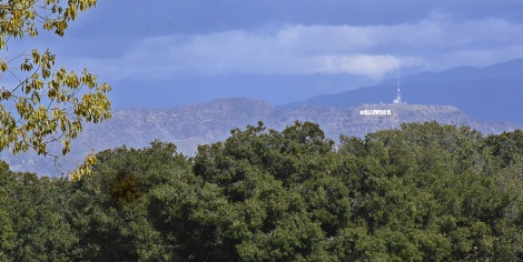
Cahuenga Peak and the Hollywood sign seen from Kenneth Hahn park
When hiking in the urban wilderness you can’t be too picky with your trails. Hikes often include paved sections or are wide dirt paths, often fire or service roads, usually dirt with patches of cracked asphalt riddled with pot holes. But none of these really give you the feeling that you are hiking, trekking in uncivilized terrain. Then there is the Burbank Peak and Aileen Getty Ridge trails at the western end of Griffith Park. Starting in a neighborhood in the Hollywood Hills, this rugged little trail scrambles up to the top of Cahuenga Peak before dropping down to overlook the Hollywood sign.
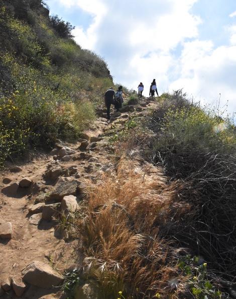
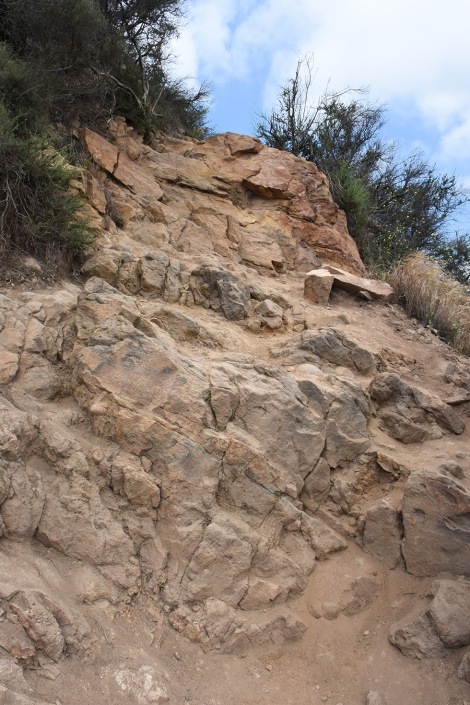
The trail to the first view point, Burbank Peak, definitely won’t be mistaken for the usual fire roads that make up hiking in Los Angeles
There’s something about a narrow dirt trail weaving through brush and up hillsides. It wakes up the explorer inside, it allows the mind to believe it’s discovering unknown territory. Yes, I know from the overlook there’s the 101 jammed with traffic, but go with me on this. Keep eyes open, much can be discovered.
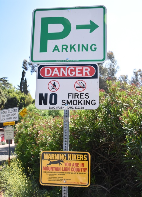
Mountain lion warning!? Now that’s what I call the urban wilderness!!!
While you always have a view of the city below, around you is wilderness. There’s even a sign near the trail head warning about mountain lions. Besides city views and apex predators, there is also show biz! The Burbank Peak/Aileen Getty Ridge trail is one of the shortest paths to the Hollywood sign, but it is not the easiest. Just over three miles round-trip, the trail climbs nearly 900 feet in elevation, most of it in the first half mile. The trail is uneven and rocky with very little shade. If you have hiking boots, wear them. Otherwise make sure your shoes have sturdy soles and are broken in. Bring plenty of water.
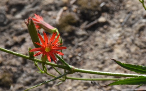
A cardinal catchfly (Silene laciniata ssp. laciniata) is one of the many wildflowers found in this area
It’s not a trail for solitude, but it isn’t crowded either. A lot of the fellow hikers are tourists wanting to get close to the Hollywood sign. Others are taking advantage of the steep climb for a good workout. As such, it seem most of the people were oblivious to the nature around them. That often seems the case hiking, travelers so focused on the destination – the incredible view or the amazing landmark – they saunter right past a hundred unique sights.
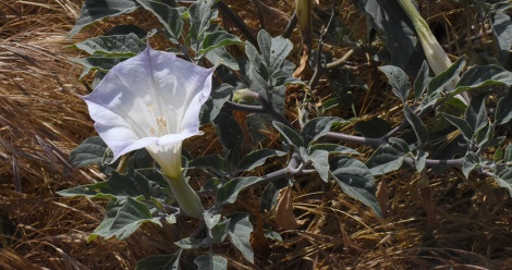
In fields along the road to the trailhead some native plants can be found, including this sacred datura (Datura wrightii)
Park on Lake Hollywood Drive south of the intersection of Lake Hollywood and Wonder View Drive. A short walk up to the end of Wonder View Dr. and the fire road that continues is the trailhead. It quickly starts up a rocky path into the brush.
The habitat is a mix of coastal sage brush and chaparral. Laurel sumac (Malosma laurina) appears to be the dominant plant, but I noticed none of the plants were very large. Laurel sumac can grow up to 18 feet high, few in this area were more than 5 feet high.
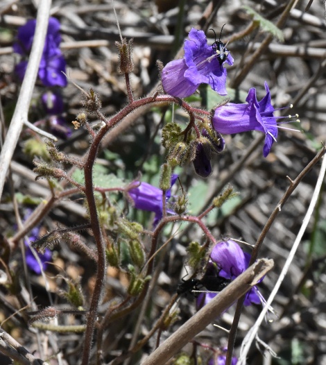
California bluebells (Phacelia minor). This picture is a reminder to take my own advice and go slow and observe carefully. I didn’t realize there were beetles on the flowers till I viewed the photo back at home.
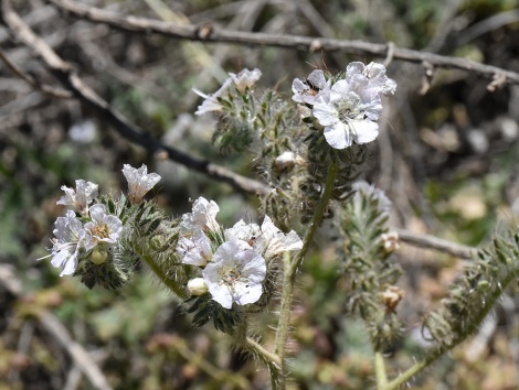
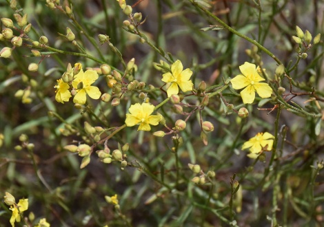
A lot of non-native grasses grow in the area, but it is dominated by native flora. Intwine in the laurel sumac grows wild cucumber (Marah macrocarpa) with its prickly seed pods. California bush sunflowers (Encelia californica) threw splashes of yellow across the hillside, with purple California bluebells (Phacelia minor) and ghostly white caterpillar phacelia (Phacelia cicutaria) adding accents.
Caterpillar phacelia (Phacelia cicutaria) were common along the trail edge
But it was hard to fully appreciate the flowers as I climbed up, pausing often to catch my breath. I did this hike twice, a week apart. The first time my dog Rocky accompanied me and I’m sure he thought I was nuts. It was the first warm day in weeks and we hadn’t hiked much recently because I was recovering from a sore foot.
I found this trail by googling ‘good hikes for dogs.’ And while dogs on leashes are welcome to hike here, this may not be the best trail for dogs, especially in warm weather. As I mentioned, there is very little shade and the trail is very steep. In fact someone had put up a sign near the trail head warning people about the overheating danger for dogs on this trail.
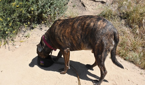
Rocky takes one of many water breaks
My dog is a big guy with a dark brown coat and is in good shape. Dogs don’t have a good way to regulate body temperature since they don’t sweat. Panting helps some but is of limited use. By the time we reached the top he was panting very heavily and quickly gulping down the water I gave him. With any large shrub we came upon offering shade, he would climb under it and plop down. So before reaching the trail end, I decided to turn back, taking many rest stops along the way.
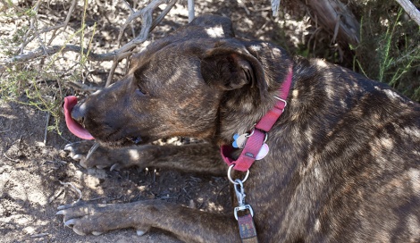
Be sure not to push your best friend too hard while out hiking, especially in warmer weather.
I wouldn’t recommend this hike for dogs except in cool weather. Be sure to bring a lot of water for the dog. You can purchase collapsable water bowls at pet stores. When doing any strenuous hiking or exercise with your best friend, be sure to know the signs of overheating. When I did this trail the following week, he stayed home. For more information on recognizing overheating in your dog, see PetMD.com.
A view of the Lake Hollywood Reservoir from the trail.
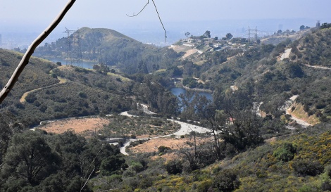
There is hardly any point on this hike where you don’t have a views of Los Angeles. Indeed, this would be an awesome hike during winter following a day or two after a rain storm. But today was hazy so the views weren’t as clear as possible. Still I regularly stopped and took in the view. Very quickly you start overlooking the Lake Hollywood Reservoir. Created in 1925 with the completion of the Mulholland Dam, the reservoir provided drinking water to L.A. till environmental policies changes deemed the water no longer acceptable for drinking. However, the reservoir still serves a function for fire-fighting helicopters filling up on water. (See Take a closer look at Lake Hollywood)
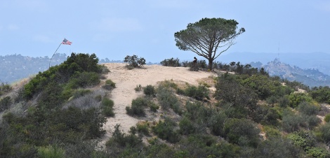
Burbank Peak with the Wisdom Tree. The tree is a non-native pine planted years ago that was an only survivor from a wildfire.
After the steep climb, the trail reaches a small saddle on the mountain ridge. Head left for a short detour to the first view point, Burbank Peak, also called Wonder View. Here you can overlook the Cahuenga Pass where the 101 freeway snakes from the L.A. basin to the San Fernando Valley.
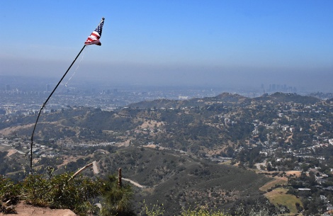
A makeshift 9/11 memorial overlooking Los Angeles
A lone pine tree, dubbed the Wisdom Tree, grows off to one side of the peak. Beneath is a box full of journals for hikers to leave a note. On the opposite side of the peak a crooked flag pole hangs over the edge holding an American flag – an improvised memorial to 9/11.
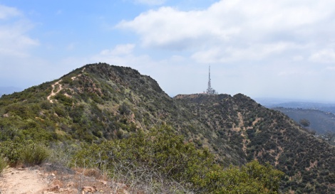
From Burbank Peak, the next two destinations – Cahuenga Peak and Mt. Lee – can be seen.
After a short water break, head back to the saddle and continue up towards Cahuenga Peak. At 1820’ above sea level, Cahuenga Peak is the twelfth highest peak in the Santa Monica mountains but at the eastern end of the range is the high point. The trail continues climbing but is a more gradual grade.
A flower cluster on chamise (Adenostoma fasciculatum), one of the dominant plants of the chaparral
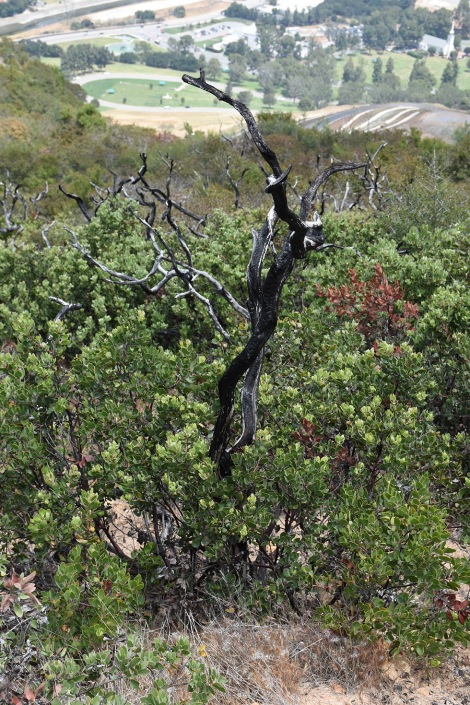
Laurel sumac is no longer the dominant plant, that role having be taken over by chamise (Adenostoma fasciculatum). Chamise is a key plant of the chaparral community and can grow to be a large bush or small tree, but all the chamise along the trail was low, rarely higher than five feet. I suspect the low vegetation along this trail is the result of a wildfire and soon I had my proof – rising above the brush were dead twisted branch, some still covered with char.
Burnt branches from chamise are evidence of a wildfire. What’s the deal with the rock? One can only guess…
A 150 acre brush fire burned this area back in 2007, the flames reaching to top of Cahuenga Peak. But besides a few charred branches and the low vegetation, little evidence of the fire remains. The plants have made an impressive comeback given that since 2007 Southern California had seven years with below average rainfall, including a 5 year record-breaking drought. Many of the plants in the coastal sage scrub and chaparral have basal burls – a thick root base that can quickly sprout new growth if anything happens to the above ground growth. (For an insight into chaparral and the myth it is design to burn, see Chaparral Myths)
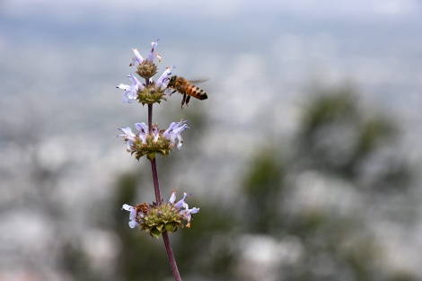
A bee gathers nectar from the flowers of Black Sage (Salvia mellifera)
But chamise isn’t the only plant along the ridge. This section of the trail is a wonderful primer on the variety of plants found in this region. Some of the them are common through out the area such as black sage (Salvia mellifera) and California sagebrush (Artemisia californica). The black sage was in full bloom, flower stalks rising above with whorls of whitish-lavender flowers. As I walked past the sages, I would rub a leaf between my fingers and sniff the deep aroma left behind. It gave me a quick boost of energy and an extra spring in my steps. Perhaps all in my head, but the strong sage smell was helpful on this trail.
The flowers of California buckwheat (Eriogonum fasciculatum). Notice the pink buds of the future flowers
California buckwheat (Eriogonum fasciculatum) is another common plant. Buckwheats tend to be late bloomers. Some of the plants were still forming their flower stalks, others were in full bloom, covering the bush in snowy white. Buckwheat flowers last a long time and dry to a dark brown, lingering through the Fall.
Swifts were daredevils flying up on the ridge, swooping low over the brush looking for insects to snatch. Their moves rivaled those of the Blue Angeles. It is worth taking a few minutes to watch them. But they are fast – too fast for me to catch them with my camera!
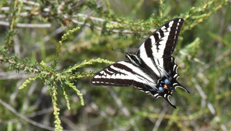
A pale tiger swallowtail (Papilio eurymedon) takes a short rest.
Another creature putting on an aerial show were pale tiger swallowtails (Papilio eurymedon). When one swallowtail encounter another, they would fly up high and come tumbling down together. Whether they were fighting over territory or mating, I couldn’t tell. You know how it is with bugs. Occasionally, the butterflies would stop for a short rest, holding out their white and black striped wings with a splash of metallic blue near the base.
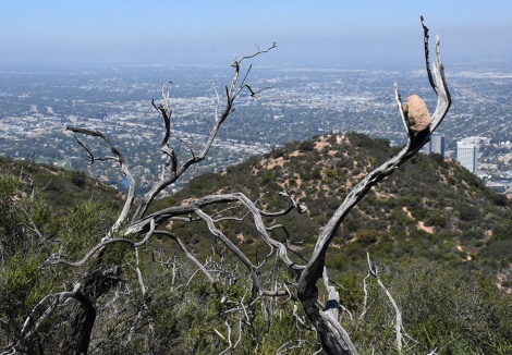
A renewed Eastwood Manzanita (Arctostaphylos glandulosa) surrounds it old trunk
Near the top of the peak was a large patch of Eastwood manzanita (Arctostaphylos glandulosa). The plants were full and healthy with a dead trunk, often charred, sticking up in the middle. The old trunks, four to six feet above the new growth, showed the rejuvenated plant still had a way to go before maturity. The old trunks were twisted and gnarled, reflecting the craggy growth of manzanita. Most manzanitas flower in Winter or early Spring at the end of the branch. The flowers will cause the branch to stop growing in that direction and the growth takes off in a new direction.
Peak Rush rose (Helianthemum scoparium) is endemic to California
A couple of new wildflowers (to me) I came upon. One was a bright yellow flower, less than an inch wide, on a low green shrub. With a little research, I identified it as a peak rush rose (Helianthemum scoparium). Quite a dynamic, exciting name for a little flower.
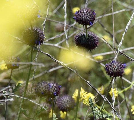
Surrounded by invasive mustard plants, a patch of chia (Salvia columbariae) manages to grow.
Off the trail and almost hidden by invasive wild mustard, were stalks lined with dark spiky balls sporting a few dark purple flowers. It wasn’t hard to mistake them for anything else beside a type of sage. It was chia (Salvia columbariae), an annual wildflower from the sage family and a close relative to the chia (Salvia hispanica) bought at health food stores. S. columbariae chia was used extensively by the California Native Americans both as food and medicine.
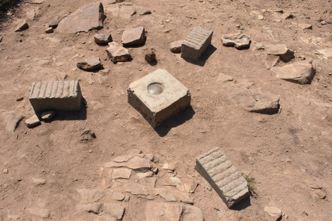
One of the less impressive summit markers mark Cahuenga Peak
Finally I reached the top of Cahuenga Peak. Marked by a few concrete blocks and surveyor marker I seemed to be the only one stopping to savory reaching the top. Everyone else just continued on to get to the Hollywood sign that sits on the side of the lower Mt. Lee. From here I was able to see the whole of Los Angeles – the coastal basin with downtown to the south, San Fernando Valley to the north. Paramount Studios and Netflix were on one side, Disney Studio and Warner Brothers on the other. Yes, there was no one else in Hollywood higher than me!
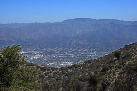
From this ridge in the Santa Monica mountains can be seen two other mountain ranges that Los Angeles partially encompasses – the Verdugo Hills and the San Gabriel Mountains. The high point seen is Mt. Lukens.
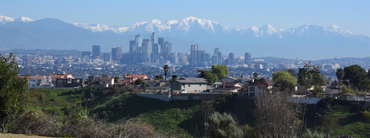
I don’t know of any other city that has a mountain range cutting right through its middle. Unfortunately, haze from morning clouds and smog limited my view. On a clear Winter day following a rain storm I would have seen Catalina Island nineteen miles off the coast. Still, to the north, I could see two other mountain ranges that encompasses parts of Los Angeles – the Verdugo Hills, which aren’t really hills, and the San Gabriel Mountains. I could see bulky Mt. Lukens on the San Gabriel front range. The mountain ridge forms the northeast border of the city of Los Angeles. With the peak at 5,075 feet above sea level, it gives the City of Los Angeles an elevation range of almost one mile.
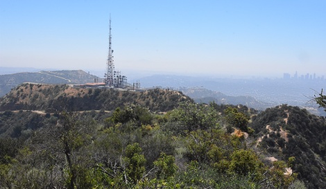
Seen from Cahuenga Peak is the communication tower on top of Mt. Lee.
The trail continues on to the Hollywood sign with a series of downs and ups as it follows the ridge. At places the trail matched the steepest sections found at the trail head, though luckily none of those stretches were as long.
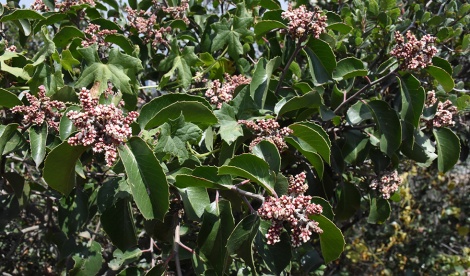
Sugar bush (Rhus ovata) with its flower clusters. The maple-shape leaves are part of a wild cucumber plant (Marah macrocarpa) entwine in the bush.
Here were many unique plants less ubiquitous in the Southern California region compared to black sage, laurel sumac, and California sagebrush. Descending down the eastern ridge of Cahuenga Peak, the trail got crowded by the chaparral on both sides. Perhaps this section wasn’t touched by the brush fire as the plants tended to be taller and more dense, providing the only shaded section on the whole trail.
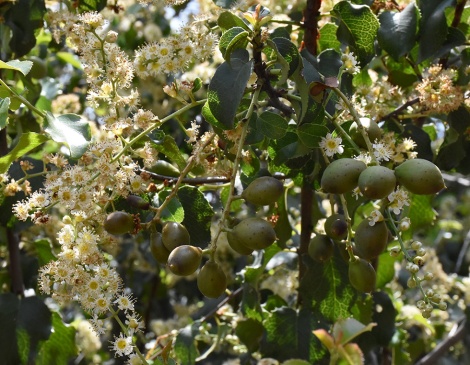
Flowers and ripening fruit on a holly leaf cherry tree (Prunus ilicifolia ssp. ilicifolia)
A holly-leaf cherry tree (Prunus ilicifolia ssp. ilicifolia) was in full bloom. Tight clusters of white flowers covered the tree with bees busily going from one cluster to the next. The leaves are a dark green with pointed edges, hence the name holly-leaf. Hanging off one of the branches were cherries, still green and forming. Once ripen, the cherries are edible but tend to be mostly seed and aren’t as sweet as domesticated ones.
The last flower cluster on a greenback ceanothus (Ceanothus spinosus)
Elsewhere in Griffith Park, I’ve seen hillside full of ceanothus but came only upon one on this hike greenbark ceanothus (Ceanothus spinosus). Ceanothus are earlier bloomers and this plant had only one last cluster left.
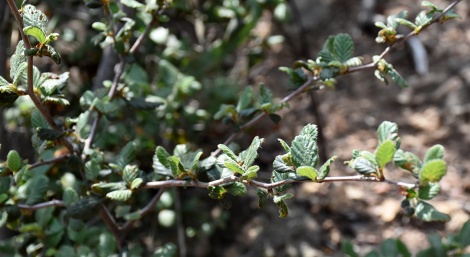
The small leaves on the Birch Leaf Mountain Mahogany (Cercocarpus betuloides var. betuloides) is a common adaption of chaparral plants to reduce moisture loss
Birch leaf mountain mahogany (Cercocarpus betuloides var. betuloides) was very common up here. Ranging in size from a medium bush to a small tree, mountain mahogany is found in many regions in California. In my old yard, a year before moving, I tried planting it. It didn’t get planted till mid-Spring and it didn’t get enough water over the summer so it never really thrived. It is a slow grower so perhaps if the new homeowner care for it, it will take off.
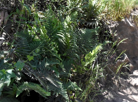
In a shaded patch grows coastal wood fern (Dryopteris arguta)
Because the plants here were tall and dense enough to provide shade, I found one plant I wouldn’t have expected on this high, dry mountain side – ferns. Just a small patch along the trail side, nestled in the shady base of larger plants. At this point, the trail dipped below the ridge on the north side of the mountain which help protect the ferns from the full impact of the sun. I’m not 100% confident, but I believe the fern was a coastal wood fern (Dryopteris arguta).
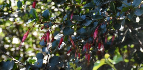
The fading flowers of a fushcia flowered gooseberry (Ribes speciosum)
Another plant was the fuchsia flowered gooseberry (Ribes speciosum). I would had missed it if it weren’t the red tubular flowers hanging down from its branches. The flowers appeared a little wilted, like they were just past their peak but charming nevertheless.
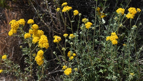
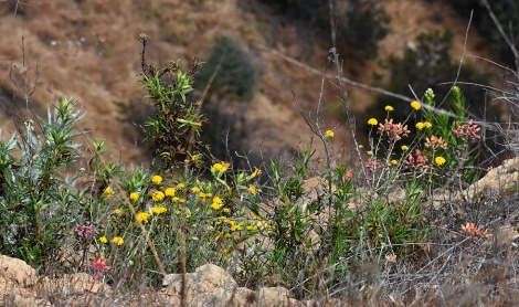
A patch of golden yarrow (Eriophyllum confertiflorum)
The trail went back onto the ridge and the vegetation became more open. The most common flower here was golden yarrow (Eriophyllum confertiflorum) – bright yellow flowers growing in tight clusters. The plant is composed of a group of upright stalks with long, jagged leaves with the flowers at the stalk’s end.
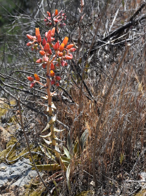
The reddish orange flowers of this lancelet dudleya (Dudleya lanceolata) give away the plant’s hiding place
Among the golden yarrow were bunches of red waxy flowers. Another plant I would had missed if it weren’t for the flowers. Lanceleaf dudleya (Dudleya lanceolata) is a small succulent, similar in shape to agave or aloe. It’s triangular leaves formed a tight rosette only a couple of inches high, six inches wide. From it rises a stalk almost a foot high with its red flowers. Without the flower stalk, the rosette would easily been hidden among the grasses and golden yarrow around it.
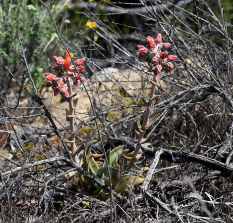
Among dead branch grows a lanceleaf dudleya
There are several species of dudleya in California, most are small with some getting up to a foot wide and high. All produce flower stalks with colors ranging from yellow to orange to red. Dudleyas can be purchased at many native plant nurseries. As with any succulent or cactus, don’t dig them up in the wild.
A cliffside flower garden
Dudleya require quick draining soil. The sandstone ridge the trail was traversing fitted the bill. On either side of the ridge, the mountain side dropped quickly and the dudleya and golden yarrow made for a gorgeous cliff side rock garden.
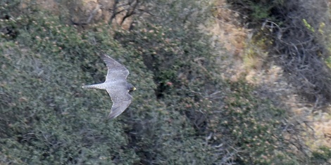
A peregrine falcon (Falco peregrinus) patrols the mountain sides of Cahuenga Peak
Looking down this cliff side garden, another thing caught my attention. Here the sides of the mountain formed a large bowl that opened up to the San Fernando Valley. The bowl was covered with chaparral with no sign of development till the far end where Forest Lawn cemetery sat just outside the bowl. Flying over it all, but below me, was a peregrine falcon (Falco peregrinus). It appeared to be halfway up the slope, gliding along the curve of the bowl, going from one end to the other and back. Here, in the middle of a metropolis of ten million people, this falcon still flys over a remanent of chaparral that its ancestors had for thousands of years.
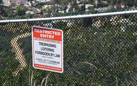
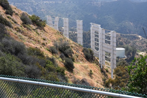
Keeping trouble makers away from the Hollywood sign
As the trail approached the Hollywood sign, a large chain-link fence appeared to one side of the trail. Having been the repeated target of practical jokes, the fence was the humorless response. At over six feet high, any view to be seen is through the chain mesh. Along the fence ‘No Trespassing’ signs are posted threatening fines and jails. If you wanted to know what it is like trying to make it into Hollywood, this fence is a pretty good metaphor.
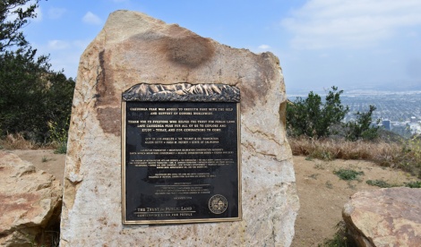
A plaque thanking those who donated money for the purchase of Cahuenga Peak
The trail drops down and meets up with a paved service road that leads up to the radio tower on the top of Mt. Lee. Where the trail and road meet is a plaque honoring the people who helped save mountain side the trail had just wander through. Though the Hollywood sign is a recognized symbol for Los Angeles throughout the world, the land around it was private. Originally, the Cahuenga Peak was owned by Howard Hughes. He proposed to build an mansion on the top for Ginger Rogers. Luckily Ginger said no.
The land was purchased from the Hughes estate in 2002 by a Chicago investment group for under 2 million dollars. They got the property zoned for four luxury homes and, in 2008, put the property on the market for 22 million dollars.
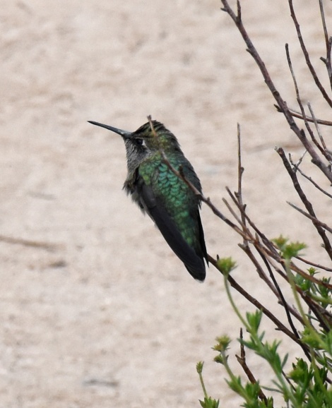
A hummingbird takes a rest along the trail
Hiking this I had to wonder what they were thinking. A housing development wouldn’t just destroy the chaparral covering the slopes, but would destroy the mountain itself. Cahuenga Peak is steep and rugged with not enough flatland to place an outhouse. The mountain would have been blasted, bulldozed and beaten down. While the flora was able to rebound after the wildfire, the mountain would have never recovered from this ill-conceived development.
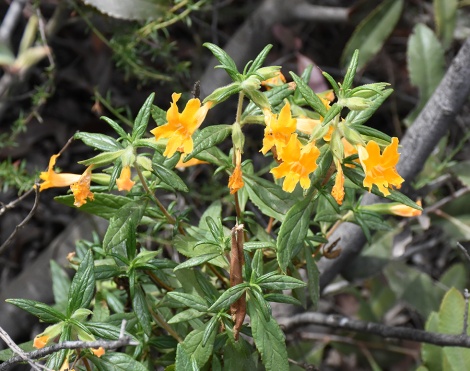
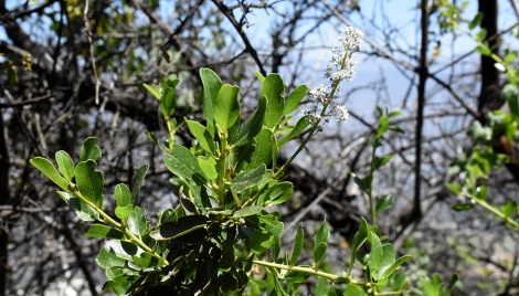
Sticky monkeyflower (Mimulus aurantiacus)
Luckily, when news of this sale offer became known there was outrage. The view of the Hollywood sign would be ruined with houses to the west of it, and destroy some of the last open land within Los Angeles. The City of Los Angeles was only able to raise 6 million to purchase the land. The residences of Los Angeles began a campaign to raise the money needed to purchase the land from the developer. Donations came in from around the world. Among the donors were some Hollywood heavyweights – Steven Spielberg, George Lucas, 20th Century Fox, Warner Brothers – but it didn’t look like enough money was going to be raised. As the purchase deadline quickly approached along came Hugh Hefner, the only conservationist who spent his days in a bathrobe. His last minute donation of $900,000 sealed the deal. There’s an overlook before the trail meets up with the paved road named after him.
Hollywood Sign, Part I
About a hundred yards or so further along the pave road, I found myself above the ‘H’ of the sign. The truth though is the Hollywood sign is a little disappointing up close. Monuments in other cities are impressively substantial. Blocks of marble and granite they seem impervious to time (though time knows better). But the Hollywood sign is just sheet metal mounted on steel poles. Of course, it was never meant to be enjoyed up close. Originally put up in 1923 for a real estate development in Beachwood Canyon below called Hollywoodland, the large advertisement struck a chord in the civic leaders. The letters ‘land’ were taken down and a symbol of California dreamin’ was born.
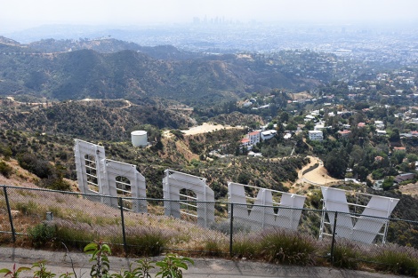
Hollywood Sign, Part II: The Revenge
This is the closest one can get to the Hollywood sign and it’s the back of the sign. When I informed a couple of women on the trail that you couldn’t actually get to the sign and all you can see from here is the back, they were bummed. That incredible Instagram post, standing next to those big white letters just wasn’t going to happen.
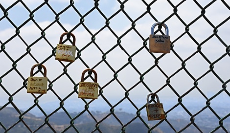
The Avitia family, Jonathan & Kasia, and Brooke & Spenser have left their mark in Hollywood
Apparently leaving a padlock on the fence is a thing. How this started I don’t know but there were padlocks all over the fence. Some were blank, some had a name written on them, many had two names – a modern day version of lovers carving their initials on a tree.
The pave road comes to a locked, razor-wired lined gate guarding a large communication tower and complex. A short dirt path curves off from the road and in a few feet you are standing on the summit of Mt. Lee at 1709 feet above sea level. Actually, you are 69 feet below the summit and no matter how good of a climber you are, you will never reach it.
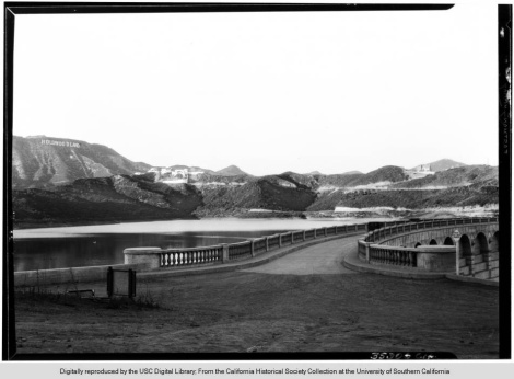
The Hollywoodland sign seen from the Lake Hollywood Reservoir (September 4, 1927). Photos from USC Digital Library
One of the developers of Hollywoodland was Mack Sennett, an early filmmaker behind the Keystone Cop films. He had a dream of building an incredible mansion on the top of Mt. Lee for him to lord over Hollywood. Huge steam shovels were brought up to flatten out the mountain top. Once flattened Sennett would build his dream house except economics kicked in (or should I say dropped out?) and the stock market crash of 1929 wiped out most of Sennett’s fortune. It is on this flatten area where the communication tower now sits. See What Flatten Mt. Lee for more of this story and to see how Mt. Lee originally appeared.
This isn’t a rock wall, this is the trail!
At this point, it is time to start back down. Unfortunately, that steep downhill descent from Cahuenga Peak now had to be climb. Back at the peak, I rested a little. A hummingbird rested nearby too and a western fence lizard (Sceloporus occidentalis) enjoyed a honeybee snack. It’s been a great outing and I reminded myself once again to come back here next Winter when the sky is clear and the view will be for forever.
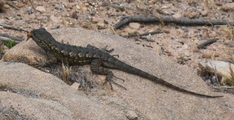
What’s the best way to eat a honeybee? Start at the head and leave the stinger for last.
Soon I was back at the saddle between Cahuenga Peak and Burbank Peak. With one last glimpse at the Wisdom Tree, I turned onto the steep rocky section of the trail that winded me on the way up. Even now it was a tricky trail. The uneven terrain, rocky steps and the loose soil make this section treacherous to tired legs and feet. Taking my time, I enjoyed the views of Lake Hollywood and the winded look on the hikers’ faces heading up.
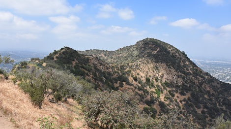
Looking back at Cahuenga Peak from Mt. Lee
All photos by Alan Starbuck except as noted
Trailmap for Griffith Park is here. Burbank Peak/Aileen Getty Ridge trail are found at the west end of the park.
To get driving directions to the trail, use Google Maps and enter ‘Starting point of Wisdom Tree Hike.’

Wow! I feel as if I’ve had my morning workout just reading about the experience. Always love an excuse to stop and take a breath when I’m hiking by getting to know the wildlife along the trail. It takes as much discipline to stop and examine the activities of the tiny creatures inhabiting the side of the trail as it does to make it up to the top. How much we miss getting from point A to point B without stopping to “smell the roses”.
LikeLiked by 1 person
Thanks Eleanor for the comment. Definitely taking time to observe the little details improves any hike. But it is easy to get too focus on covering distance.
LikeLike
Interesting hike.Do not think I will be making it but liked sharing your hi!e.
LikeLiked by 1 person
Thanks for the comment. It is a good workout but luckily there plenty of easier trails in Griffith Park.
LikeLike
You know, I have never been to Mount Lee, and have never seen the Wisdom Tree. (It is an Italian stone pine.) There is so much there that I have never seen. I want to see the Bat Cave too!
LikeLiked by 1 person
The Bat Cave is pretty cool and an easy hike. Unfortunately the Batmobile is no longer there!
LikeLiked by 1 person
It is out fighting crime!
LikeLiked by 1 person